Articles

Mexican States
Southwest United States
Heritage and Governance
Mexican Colonial Migration as a Catalyst for Assimilation (1550-1821)
For centuries, Mexico has led the world in silver production. In 1546, during Mexico’s colonial period, silver was first discovered in Zacatecas, but many more mines would be opened up in the next two centuries. According to Michael M. Swann, “Migrants in the Mexican North,” the “silver centers attracted large, mixed populations from great distances.
The Native People of Nueva Vizcaya and Nueva Galicia
The following tables contain information of the native people of the Spanish jurisdictions in Nueva Galicia, Nueva Vizcaya, Sonora and Sinaloa. These extracts primarily contain information about the indigenous groups occupying these areas at the time of the Spanish contact, the year of which varies from one place to another. However, Peter Gerhard’s book contains a wealth of local information, and it is highly recommended that interested researchers purchase the book to have access to all the information provided.
Indigenous Chihuahua: Four Centuries of Conflict
The Sierra Madre Occidental Mountains run from south of the Arizona-Sonora border southeast through eastern Sonora, western Chihuahua, Sinaloa, Durango, Zacatecas, Jalisco and farther south. The Sierra Madre Oriental Mountains run parallel to the Sierra Madre Occidental range on the eastern side of the country.
Divided Loyalties: The Indigenous Peoples Who Occupy the US-Mexico Borderlands
This presentation discusses the native groups that occupied the regions adjacent to and on both sides of the U.S.-Mexico border over the last three centuries. While some of these tribes are well-known to us today (i.e., the Yaquis, Tohono O'odham, Kumeyaay, etc.), tribal groups that have nearly disappeared as distinguishable cultural entities (i.e., Carrizos, Mansos, Jocome, Coahuiltecans, etc.) will also be discussed. In addition to the history of those tribes, we will explore the current status of some of the tribal communities that still exist today.
Indigenous Chihuahua and the Census
From 1895 to 2015, the Mexican census has painted a picture of Mexico’s people, providing details about languages spoken (Spanish, foreign and indigenous), religion, education, literacy, employment and migration. From the beginning, the Mexican census provided details about indigenous languages spoken by its citizens. However, in the first half century, it is possible that there were undercounts of indigenous language speakers because some may have failed to declare their language status for fear of affecting their position within the community. In addition, poor communications channels with rural, isolated indigenous communities may also have caused an undercount of the indigenous people.
Mexico’s 1921 Census: A Unique Perspective
In the aftermath of the Mexican revolution, Mexico’s Departamento de la Estadística Nacional administered a census that would be unique among Mexico’s census counts administered between 1895 and 2005. In this new census, the Mexican Government decided to ask Mexicans about their perception of their own racial heritage. In the 1921 census, residents of the Mexican Republic were asked if they fell into one of the following categories:
The Mexican Revolution and its aftermath 1910-1929
Porfirio Díaz (1830-1913) ̶a native of Oaxaca came to power in 1876 and essentially ruled the country until 1911. He was responsible for economic growth, industrialization and enhanced foreign investment, but had little regard for human rights. Diaz’s rule was both harsh and arbitrary. Much of Mexico’s economic system during his rule revolved around the hacienda system.
Cesar Chavez: Roots Deep in the Heart of Chihuahua
Cesar Chavez was an American hero, a person who was admired by both his supporters and his adversaries. In grammar school, many students learn about his advocacy and dedication to his causes, but few people know much about his roots. Nearly everyone knows that Cesar Estrada Chavez was born on March 31, 1927 near Yuma, Arizona. The Arizona State Board of Health Certificate of Birth Number 594 states that Cesario Chavez was the legitimate son of Librado Chavez (38 years old, a farmer born in Mexico) and Juana Estrada (35 years old, a housewife also born in Mexico). His birthplace was listed as “North Gila Valley” in Yuma County. A copy of that birth record has been reproduced below [Arizona Department of Health Services, “Arizona Genealogy Birth and Death Certificates: Index.” Online: http://genealogy.az.gov/].
Dual Identity: The Indigenous Peoples Who Occupy the U.S.-Mexico Borderlands
This presentation discusses the native groups that occupied the regions adjacent to and on both sides of the U.S.-Mexico border over the last three centuries. While some of these tribes are well-known to us today (i.e., the Yaquis, Tohono O'odham, Kumeyaay, Cocopah, etc.), tribal groups that have disappeared as distinguishable cultural entities (i.e., Carrizos, Mansos, Jocome, Coahuiltecans, etc.) will also be discussed. In addition to the history of those tribes, we will explore the current status of the tribal communities that still exist today.
An Entire Frontier in Flames: The Regional Implications of the Pueblo Revolt (1680-1696)
Many people from New Mexico are familiar with the Pueblo Revolt of 1680 and how it drove the Spanish and mestizo population out of the region for several years. What many people do not know is that the Pueblo Revolt was actually part of a larger regional rebellion against Spanish rule.
Indigenous Chihuahua: A War Zone for Three Centuries
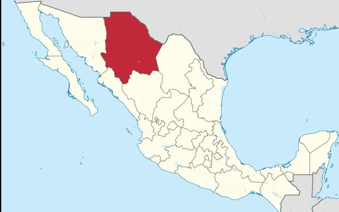
The state of Chihuahua is located within the northwest central plains of the Mexican Republic. Bordered by the United States (Texas and New Mexico) on the north and northeast, Chihuahua has a common border with Sonora (on the west and south) and with Sinaloa (on the southwest). The state of Coahuila de Zaragoza lay to the east, while Durango shares much of Chihuahua’s southern boundary.

Article Categories
- Aguascalientes 14
- Arizona 4
- Baja California 5
- Baja California Sur 2
- California 19
- Campeche 4
- Census 36
- Chiapas 3
- Chihuahua 11
- Coahuila 7
- Colima 1
- Conquistador Chronicles 2
- Durango 2
- Ethnic Identity 40
- Genealogy 35
- Guanajuato 8
- Guerrero 8
- Hidalgo 2
- Indigenous Insights 97
- Jalisco 25
- Mexico City 11
- Michoacan 7
- Morelos 4
- Nayarit 3
- New Mexico 4
- Nuevo Leon 7
- Oaxaca 6
- Politics 10
- Puebla 5
- Queretaro 1
- Quintana Roo 4
- San Luis Potosi 11
- Sinaloa 6
- Sonora 16
- Southwest US 26
- State of Mexico 5
- Tabasco 3
- Tamaulipas 11
- Texas 7
- Tlaxcala 7
- Veracruz 6
- Yucatan 6
- Zacatecas 13


