Articles

Mexican States
Southwest United States
Heritage and Governance
Quintana Roo and the Census
The present-day state of Quintana Roo is one of three Mexican states on the Yucatán Peninsula. In the pre-Hispanic period, Quintana Roo and the Yucatán were part of the Mayan World. In the colonial period, Quintana Roo became part of the Spanish Empire although much of the state maintained their Mayan culture and language.
Indigenous Quintana Roo: The Last Two Centuries (Part 2)
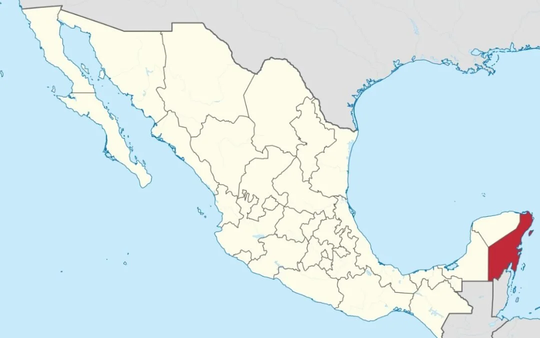
The State of Quintana Roo lies on the eastern end of the Yucatán Peninsula in Southeastern Mexico. Quintana Roo also neighbors the Mexican States of Yucatán (on the northwest) and Campeche (on the southwest) and the nations of Belize and Guatemala (on the south). The state consists of only 44,825 square kilometers, which is equal to 2.0% of the national land mass. While the western and northern coasts of the Yucatán Peninsula are on the Gulf of Mexico coast, the eastern coast of the Yucatán — including Quintana Roo — touches the Caribbean Sea.
Indigenous Quintana Roo: From the Pre-Hispanic Period through the Colonial Period (Part 1)
The State of Quintana Roo lies on the eastern end of the Yucatán Peninsula in Southeastern Mexico. Quintana Roo also neighbors the Mexican States of Yucatán (on the northeast) and Campeche (on the southeast) and the nations of Belize and Guatemala (on the south). The state consists of only 44,825 square kilometers, which is equal to 2.0% of the national land mass. While the western and northern coasts of the Yucatán Peninsula are on the Gulf of Mexico coast, the eastern coast of the peninsula — including Quintana Roo — touches the Caribbean Sea.
Indigenous Yucatán: The Center of the Mayan World
The state of Yucatán is located in northern half of the Yucatán Peninsula of southeastern Mexico. It is surrounded by the Mexican states of Campeche (southwest) and Quintana Roo (southeast) and by the Gulf of Mexico. The twentieth largest state in the Mexican Republic, Yucatán is made up of 39,524 square kilometers, or 2.0% of Mexico’s total land area, and is 20th largest state in the Mexican Republic, The State is about half the size of Maine and shares a 342-kilometer coastline with the Gulf of Mexico. The state of Yucatán has 106 municipalities. The capital of Yucatán is Mérida.

Article Categories
- Aguascalientes 14
- Arizona 4
- Baja California 5
- Baja California Sur 2
- California 20
- Campeche 4
- Census 36
- Chiapas 3
- Chihuahua 11
- Coahuila 7
- Colima 1
- Conquistador Chronicles 2
- Durango 2
- Ethnic Identity 42
- Genealogy 35
- Guanajuato 8
- Guerrero 8
- Hidalgo 2
- Indigenous Insights 99
- Jalisco 25
- Mexico City 11
- Michoacan 7
- Morelos 4
- Nayarit 3
- New Mexico 4
- Nuevo Leon 7
- Oaxaca 6
- Politics 10
- Puebla 5
- Queretaro 1
- Quintana Roo 4
- San Luis Potosi 11
- Sinaloa 7
- Sonora 17
- Southwest US 26
- State of Mexico 5
- Tabasco 3
- Tamaulipas 11
- Texas 8
- Tlaxcala 7
- Veracruz 6
- Yucatan 6
- Zacatecas 13


