Articles
Mexican States
Southwest United States
Heritage and Governance

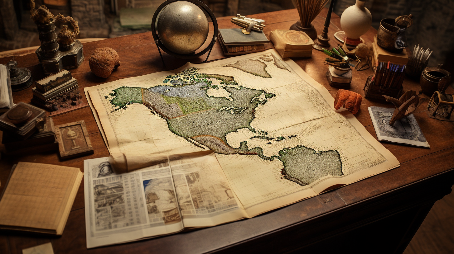
Searching for Your Indigenous Roots in Mexico
If a person is trying to determine the name of the Indian tribe from which they descend, they may find out that the answer is very complex and involves many potential tribes. Each and every one of us has four grandparents and eight great- grandparents. Fourteen generations ago – around 1540 – you had 16,384 12th great- grandparents, many of whom may have been indigenous, some of whom travelled from other areas of Mexico to the towns where your ancestors lived.

Indigenous Baja California and the Census
The State of Baja California occupies a total area of 71,450 square kilometers (27,587 square miles), which makes up 3.6% of the national territory. Baja California is the 12th largest state in the Mexican Republic. Politically, this area is divided into a total of five municipios: Ensenada, Mexicali, Tecate, Tijuana and Playas de Rosarito.

Mexico’s Indigenous Identity in the 2015 Intercensal Survey
In 2016, the Mexican government agency, Instituto Nacional de Estadística Geografía e Informática (INEGI), published the 2015 Intercensal Survey, which upgraded Mexico’s socio-demographic information to the midpoint between the 2010 census and the census to be carried out in 2020. With a sample size of over 6 million homes, this survey provides information on the national, state and municipio level, as of March 15th, 2015.
Indigenous Jalisco in the Sixteenth Century: A Region in Transition
Jalisco is La Madre Patria (the Mother Country) for millions of Mexican Americans. Given this fact, it makes sense that many sons and daughters of Jalisco are curious about the cultural and linguistic roots of their indigenous ancestors.

Indigenous Jalisco: From the Spanish Contact to 2010
The modern state of Jalisco consists of 78,597 square kilometers located in the west central portion of the Mexican Republic and taking up 4.0% of the national territory. As the seventh largest state in Mexico, Jalisco is politically divided into 124 municipios. With a 2010 population of about 7,844,830 inhabitants, Jalisco has the fourth largest population in Mexico with 6.6% of the national population.

Indigenous Aguascalientes: The Sixteenth Century Land of War
The State of Aguascalientes, located in central Mexico, is one of the smallest states in the Mexican Republic. Sharing its borders with Jalisco (on the south) and Zacatecas (on the north, west and east), Aguascalientes occupies a total of 5,616 square kilometers (2,168 square miles), which represents only 0.3% of Mexico’s national territory and is the twenty-eighth largest state in terms of area. Politically, Aguascalientes is divided into eleven municipios.

The Náhuatl Language of Mexico: From Aztlán to the Present Day
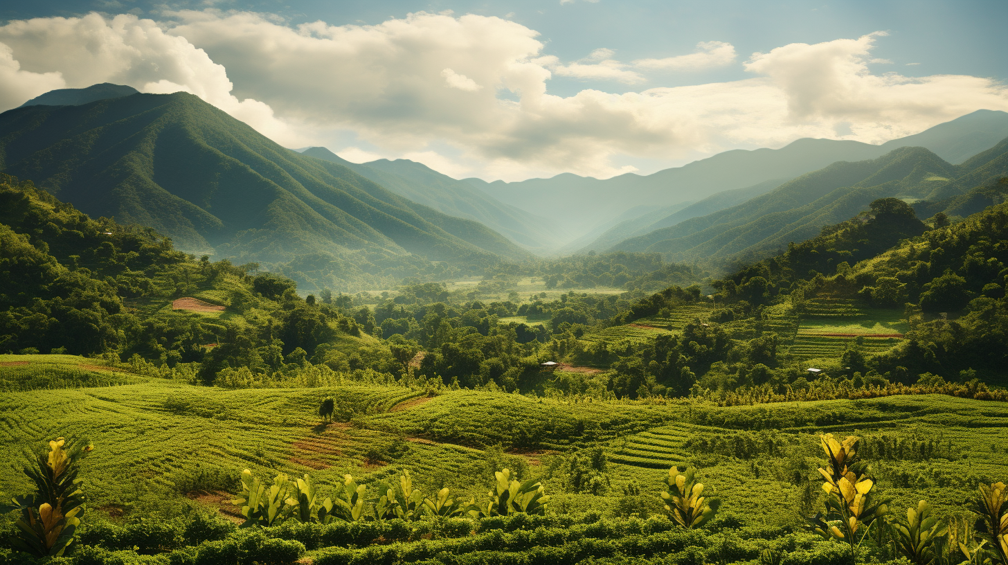
Across the 761,606 square miles (1,972,550 square kilometers) that comprise Mexico you can find a great variety of landscapes and climates. While mountains and plateaus cover more than two-thirds of her landmass, the rest of Mexico’s environment is made up of deserts, tropical forests, and fertile valleys. Mexico’s many mountain ranges tend to split the country into countless smaller valleys, each forming a world of its own. Over the last few thousand years, this has been a factor in the differentiation of a wide range of indigenous Mexican languages.

Who Were the Chichimecas?
If your ancestors are from Zacatecas, Guanajuato, Aguascalientes, Jalisco or San Luis Potosí, it is likely that you are descended from the indigenous peoples who inhabited these areas before the Spaniards arrived from the south. The historian Eric Van Young of the University of California at San Diego has called this area, the “the Center-West Region” of Mexico. This cultural region, according to Dr. Van Young, amounts to about one-tenth of Mexico’s present-day national territory.
The Indigenous History of Jalisco, Zacatecas, Guanajuato and Michoacán
Mexico’s Northern Mountainous Regions
The Sierra Madre Occidental Mountains run from Chihuahua into Durango, Zacatecas, Jalisco and farther south. The Sierra Madre Oriental Mountains run parallel to the Sierra Madre Occidental range on the eastern side of the country.

Dual Identity: The Indigenous Peoples Who Occupy the U.S.-Mexico Borderlands
This presentation discusses the native groups that occupied the regions adjacent to and on both sides of the U.S.-Mexico border over the last three centuries. While some of these tribes are well-known to us today (i.e., the Yaquis, Tohono O'odham, Kumeyaay, Cocopah, etc.), tribal groups that have disappeared as distinguishable cultural entities (i.e., Carrizos, Mansos, Jocome, Coahuiltecans, etc.) will also be discussed. In addition to the history of those tribes, we will explore the current status of the tribal communities that still exist today.

Indigenous Northeastern Mexico: The Ancestors of the Tejanos
Among all the indigenous people of Mexico, understanding the Indians of Northeastern Mexico is very challenging, as nearly all of these tribal groups have disappeared as “distinguishable cultural entities.” The largest ethnic group ̶ the Coahuiltecans ̶ ranged through much of the northeast, including parts of Coahuila, Nuevo León, Tamaulipas and southern Texas. Today they do not exist.

Indigenous Puebla: Land of the Náhuatl Speakers
There is strong evidence that Puebla has been inhabited for a long time. In fact, the skull of the Texcal Man — which was found in a cave near Tehuacán in southeastern Puebla — has been dated at 7,480 years old. For the past millennium, several cultures — including the Olmec, Toltec, Náhuatl, Popoloca, Totonac, Mazatec and Otomí cultures — have thrived in the region that is now called Puebla. However, by the 15th Century, the Náhuatl-speakers of the Aztec Empire conquered nearly all of Puebla and ruled it until the coming of Hernán Cortés and the Spaniards. When the Spaniards destroyed the mighty Aztec Empire, the empire’s Puebla territories devolved into the hands of the Spanish Empire.

Indigenous San Luis Potosí: The Land of the Huastecos and Náhuatl
The land-locked state of San Luis Potosí (SLP) is located in center- north Mexico. With a surface area of 61,137 square kilometers (representing 3.1% of the total area of the Mexican Republic), San Luis Potosí touches nine other Mexican states.

Indigenous Nuevo León: A Region of Small, Mutually Antagonistic Tribes
Some historical sources have referred to four primary indigenous groups inhabiting Nuevo León at the Spanish contact in the late 1500s. They included the Alazapas in the north, the Guachichiles in the south, the Borrados in the east and Coahuiltecans in the west. In essence all of these groups had ties to either the Coahuiltecans or the Tamaulipec bands (who were, in essence, a sub- group of the Coahuiltecans). The Coahuiltecan tribes were made up of hundreds of small autonomous bands of hunter-gatherers who ranged over eastern Coahuila, northern Tamaulipas, most of Nuevo León and southern Texas.

The Indigenous People of Central Mexico: 1111 to 1521
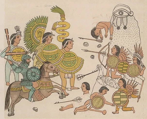
Each part of the Mexican Republic has a unique and fascinating history, but a great deal attention has been given to the Indian groups that inhabited central México, in particular the present-day Distrito Federal (Federal District), known more commonly as Mexico City. Nearly 500 years ago, Hernán Cortés marched his small army of Spaniards and indigenous allies inland from Veracruz to confront the might of Emperor Moctezuma in Tenochtitlán. And, as a result, a patchwork of native kingdoms became the colonial fiefdom of a European monarch (the King of Spain).

The Indigenous People of Mexico City: 1895-2010
Each part of the Mexican Republic has a unique and fascinating history, but a great deal attention has been given to the Indian groups that inhabited central México, in particular the present-day Distrito Federal (Federal District), known more commonly as Mexico City. In fact, in 2016, the Federal District’s name was changed to the State of Mexico City. Nearly 500 years ago, Hernán Cortés marched his small army of Spaniards and indigenous allies inland from Veracruz to confront the might of Emperor Moctezuma in Tenochtitlán. And, as a result, a patchwork of native kingdoms became the colonial fiefdom of a European monarch (the King of Spain).
Chiapas: Forever Indigenous
In recent decades, the State of Chiapas – long a neglected and oppressed region of the Mexican Republic – has been thrust onto the world stage and into the media spotlight. The attention given to the political situation in Chiapas has initiated a great interest in the plight of the indigenous people of that state. But an understanding of the present-day situation in this southern state requires a review of its history and its complex ethnic diversity.

The Indigenous History of Jalisco, Zacatecas and Aguascalientes
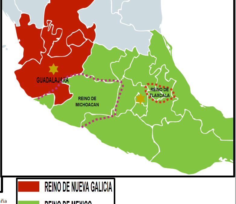
Nueva Galicia’s Indigenous People: Established in 1548, the Spanish province of Nueva Galicia embraced 180,000 kilometers and included most of present-day Jalisco, Nayarit, Aguascalientes and Zacatecas.

Indigenous Durango: Land of the Tepehuanes
The State of Durango is a landlocked state located in northwestern Mexico. As the fourth largest state of the Mexican Republic, Durango covers an area of 123,317 square kilometers and takes up 6.3% of the national territory. The state has common boundaries with Chihuahua and Coahuila de Zaragoza on the north, Zacatecas on the east and southeast, Nayarit on the southwest, and Sinaloa on the west. Politically, Durango is divided into 39 municipalities.
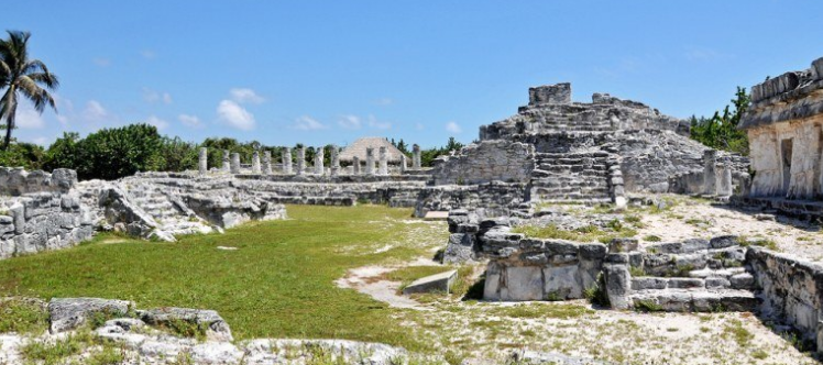
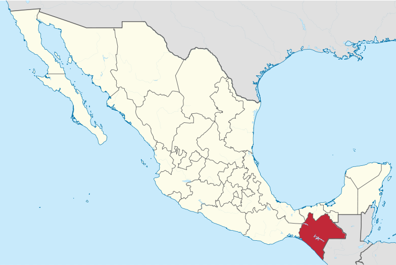
Indigenous Quintana Roo: The Last Two Centuries (Part 2)
The State of Quintana Roo lies on the eastern end of the Yucatán Peninsula in Southeastern Mexico. Quintana Roo also neighbors the Mexican States of Yucatán (on the northwest) and Campeche (on the southwest) and the nations of Belize and Guatemala (on the south). The state consists of only 44,825 square kilometers, which is equal to 2.0% of the national land mass. While the western and northern coasts of the Yucatán Peninsula are on the Gulf of Mexico coast, the eastern coast of the Yucatán — including Quintana Roo — touches the Caribbean Sea.
Article Categories
- Aguascalientes 10
- Arizona 4
- Baja California 5
- Baja California Sur 2
- California 14
- Campeche 5
- Census 32
- Chiapas 4
- Chihuahua 13
- Coahuila 8
- Colima 1
- Conquistador Chronicles 1
- Durango 2
- Ethnic Identity 31
- Genealogy 32
- Guanajuato 7
- Guerrero 8
- Hidalgo 2
- Indigenous Insights 91
- Jalisco 21
- Mexico City 9
- Michoacan 5
- Morelos 4
- Nayarit 3
- New Mexico 3
- Nuevo Leon 7
- Oaxaca 5
- Politics 9
- Puebla 5
- Queretaro 1
- Quintana Roo 5
- San Luis Potosi 9
- Sinaloa 5
- Sonora 16
- Southwest US 23
- State of Mexico 6
- Tabasco 4
- Tamaulipas 11
- Texas 6
- Tlaxcala 6
- Veracruz 7
- Yucatan 5
- Zacatecas 11